Development · Investment
THE BLUE LINE CORRIDOR IS A REAL ESTATE STORY WORTH WATCHING.
Prince George's County has approved a new long-term framework for the Central Avenue–Blue/Silver Line corridor. The opportunity is bigger than any one project — and the details will matter.
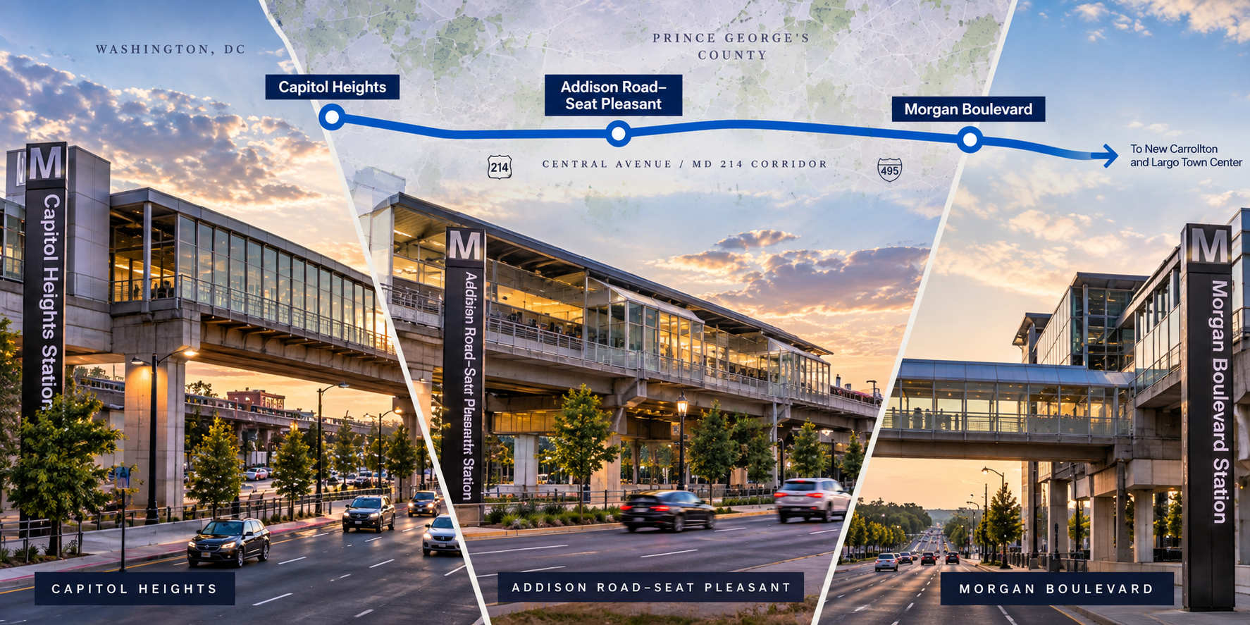
Editorial illustration of the Central Avenue Blue Line corridor.
Prince George's County has spent years talking about the potential of its Metro-served communities.
Along Central Avenue, that conversation now has a new framework.
In July 2026, the County Council approved the Central Avenue–Blue/Silver Line Sector Plan and Sectional Map Amendment.
The plan addresses a corridor extending from the District line toward the Capital Beltway and focuses heavily on the communities surrounding Capitol Heights, Addison Road–Seat Pleasant and Morgan Boulevard Metro stations.
Its long-term goals include more walkable development, residential and mixed-use growth, stronger local businesses, improved transportation and better public spaces.
That makes this more than a planning document.
It is a map of what Prince George's County wants this part of the county to become.
Why This Corridor
The infrastructure is already here.
One of the most interesting things about the Central Avenue corridor is that this is not a story about bringing rail transit to an area that has none.
Metro stations already exist.
Major roads already exist.
Established neighborhoods already surround them.
The challenge has been turning that infrastructure into the kind of walkable, mixed-use environments envisioned around major transit.
That distinction matters.
Building a station and building a neighborhood around a station are two different things.
The newly approved planning framework is intended to address that gap.
Three Stations
The opportunity isn't uniform.
Capitol Heights.
Addison Road–Seat Pleasant.
Morgan Boulevard.
All three sit along the same transit corridor.
They should not be analyzed as though they are the same market.
Each has different surrounding neighborhoods, parcels, road patterns, commercial uses and development conditions.
For investors and property owners, that means “near Metro” is not enough analysis.
The more important question is:
What can realistically happen around this particular station?
“Transit creates access.
Planning determines what a community can do with it.”
— Lance Hawkins
The Plan
From through-corridor to place.
The approved sector plan prioritizes new residential and mixed-use growth around designated centers and neighborhood-serving commercial areas.
It also emphasizes walkability, pedestrian-friendly development, multimodal transportation, economic development, community reinvestment and stronger public spaces.
That is significant because Central Avenue has historically functioned heavily as a corridor people travel through.
The longer-term planning question is whether portions of it can become places where more people also choose to stop, live, shop and spend time.
Real-estate value is often tied not simply to access, but to experience.
Can someone walk comfortably?
Are useful amenities nearby?
Does the environment support housing?
Can local businesses benefit from additional activity?
Those details determine whether transit-oriented development exists on paper or in everyday life.
What I'm Watching
Plans create direction. Execution creates place.
- 01 · ZONING The accompanying Sectional Map Amendment matters because land-use goals only become meaningful when zoning permits development that can support them.
- 02 · STATION-AREA DEVELOPMENT Watch where actual projects begin advancing around Capitol Heights, Addison Road–Seat Pleasant and Morgan Boulevard.
- 03 · CENTRAL AVENUE Improvements to the corridor itself — pedestrian conditions, streetscape, crossings and connectivity — will help determine whether nearby development feels connected or isolated.
- 04 · LOCAL BUSINESS Growth should not only be measured by how many new buildings appear. The ability of existing and new local businesses to participate in that growth matters too.
- 05 · HOUSING What gets built, at what density and at what price points will influence who can live near these transit centers.
- 06 · PUBLIC SPACE Parks, streetscapes and gathering places can determine whether development creates a collection of projects or an actual neighborhood.
- 07 · TIMING The plan looks decades ahead. Not everything will happen at once. Understanding sequencing matters when evaluating real estate today.
Investment
A plan is a signal. It is not a guarantee.
An approved sector plan can tell you where public policy is trying to direct future growth.
That is valuable information.
It is not the same thing as a completed development.
Investors still need to evaluate individual parcels, zoning, ownership, financing conditions, infrastructure, market demand and timing.
Homeowners still need to understand what is actually proposed near them.
Business owners still need to know when new activity is likely to arrive and whether the surrounding environment supports it.
The plan provides direction.
The market and execution will determine the outcome.
The Agent Lance View
Prince George's deserves a closer read.
This is exactly the kind of story I want DMV Intelligence to pay attention to.
Prince George's County is often discussed as though opportunity begins only when a headline project arrives.
That misses a lot.
There are already communities, transit stations, businesses, homeowners and infrastructure here.
The more interesting question is how those existing assets can be connected to thoughtful future growth.
The Central Avenue–Blue/Silver Line plan gives us a framework to watch.
Now the important part begins:
seeing what actually gets built.
“The opportunity isn't that Prince George's suddenly appeared on the map.
It's understanding what was already here — and what may finally connect.”
— Lance Hawkins
What to Watch Next
- Final edited publication of the approved sector plan
- Zoning implementation
- Projects around Capitol Heights
- Projects around Addison Road–Seat Pleasant
- Projects around Morgan Boulevard
- Central Avenue transportation improvements
- Housing proposals
- Commercial development
- Local-business participation
DMV Intelligence is editorial analysis from Lance Hawkins based on publicly available planning information and professional perspective. It is not a prediction of future property values or investment returns.
Back to DMV Intelligence